"These are 2026 costs, so in 10 years when it actually starts getting done, that could be up from that." That line came from Geralyn Falco, a member of Swampscott's Climate Action and Resilience Committee, during a June review of the town's new coastal flood mitigation study. She was talking about seawalls. But she could have been talking about the single question that matters most to anyone shopping for a house near Swampscott's water this year: not what flood zone you're in, but who is legally on the hook for the wall that stands between your foundation and the tide.
That distinction rarely shows up in a listing sheet. It should. Two houses a few hundred yards apart, both close enough to smell the salt air, can sit behind two entirely different futures. One is protected by infrastructure the town is actively engineering and funding. The other is protected by a wall the homeowner owns outright, repairs on their own schedule, and pays for out of pocket. Swampscott's own flood study, still in progress this year, draws that line in public for the first time.
Three Sections, One Line Of Ownership
The study, prepared by engineering firm Kleinfelder using federal ARPA funding, breaks the town's most exposed shoreline into three sections: the Fisherman's Beach parking lot and beach area, the historic Fish House, and the privately owned shoreline and seawalls along Puritan Road. The first two are public property, and the options on the table for them, from raised seawalls to tide gates to elevating the Fish House itself, are being weighed and funded through the town's own process.
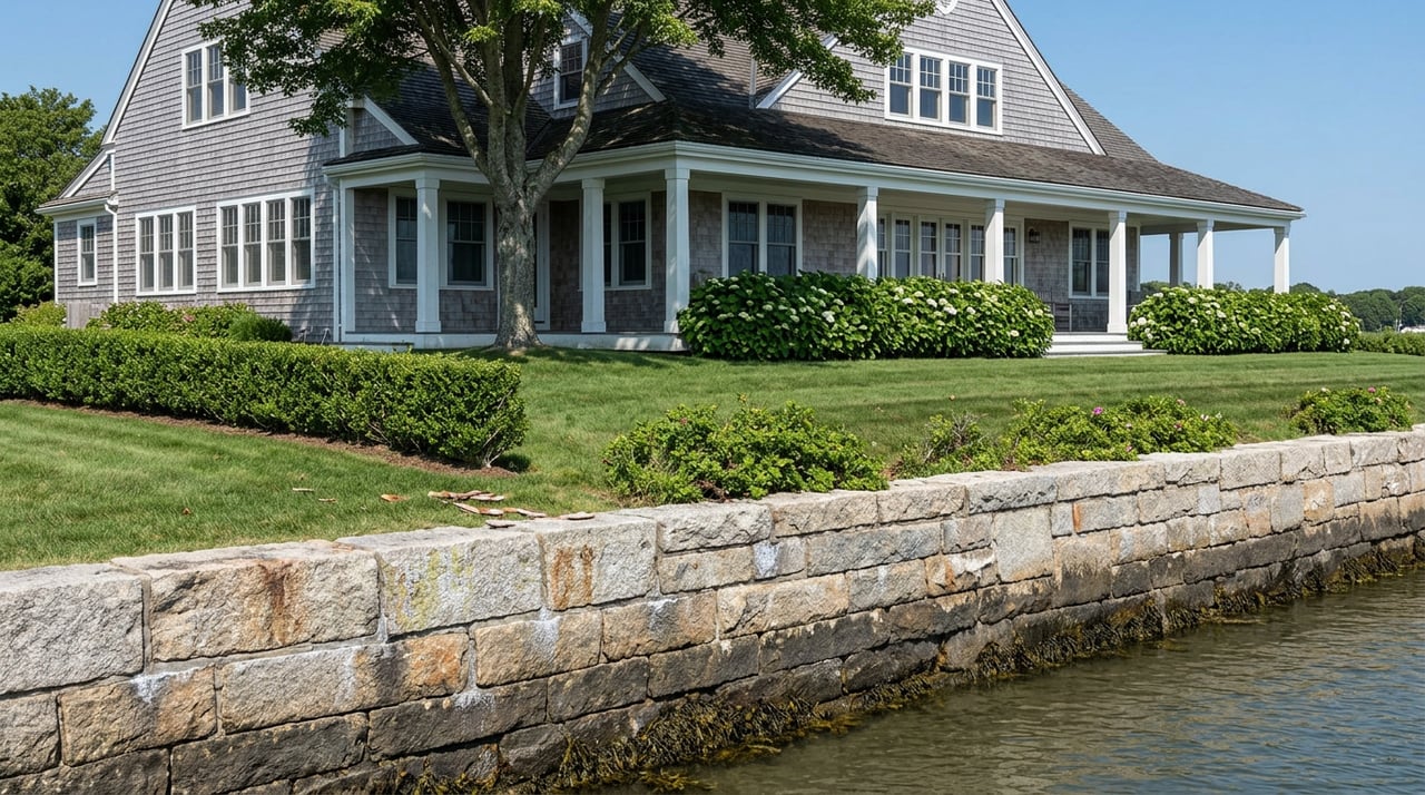
Puritan Road is different. Committee members reviewing the study noted that improvements there would require resident input because the shoreline infrastructure is privately owned, and that any future seawall work would need coordination with the homeowners who would ultimately be responsible for maintaining those structures. That is not a footnote. It is the whole story for anyone considering a purchase on that stretch of coast.
Consultant Seth Bryant told the committee that flood pathways run "pretty deeply into town past Puritan Road and Humphrey Street," and that despite being a small sliver of coastline, its low position means a flood there can spread across a much wider area. Select Board member Ted Dooley put it more plainly at that same meeting, naming the entry points for coastal flooding as Fisherman's Beach, Eisman's Beach, and Whale's Beach, the whole stretch where elevation and rainfall combine to push water inland. The town's own FEMA flood map reflects this. Map 4, the panel covering Swampscott, is carved out specifically for the coastal neighborhoods along Puritan Road between Eiseman's Beach and Atlantic Avenue, a separate designation from the rest of town's flood geography.
What Three Years Beneath A Restaurant Prove
If you want to see what "privately owned and privately maintained" actually looks like in practice, you don't have to imagine it. You can watch it happen at Mission on the Bay, the Humphrey Street restaurant whose seawall collapsed in May 2023.
More than three years later, the permanent fix is still working its way through review. In June 2026, the Conservation Commission opened its examination of a plan to replace the temporary emergency repair with a long-term stone revetment, a sloped barrier of boulders designed to absorb wave energy before it reaches the wall. LEC Environmental Consultants presented the plan as the product of years of engineering studies, environmental review, and permitting work. By late August, the proposal was still pending state review, with commission chair Toni Bandrowicz noting the process was "chugging along" and that she was glad to have a peer reviewer moving through it as quickly as they had. The original 2020 repair project along the same stretch of Humphrey Street seawall was a public one, funded by roughly four million dollars in town money over three years. The Mission on the Bay section was different because it sat on private land, and that difference is exactly why it is still unresolved.
That is the pattern the flood study is now proposing to extend down Puritan Road. If you buy a house there and its seawall needs work in five or ten years, you are not looking at a town project with town financing. You are looking at your own multi-year path through environmental permitting, state review, and the full cost of construction, on your own timeline and your own budget.
Puritan Road Has Been Here Before
This isn't a new discovery for that street. Back in 2018, a proposed redevelopment at the corner of Puritan Road and Lincoln House Avenue ran into the same issue. The property, a 1914 mansion with a carriage house, tennis court, and pool abutting Swampscott Harbor, came with its own seawall. Then-Board of Selectmen chairwoman Naomi Dreeben flagged concerns about the project's location within a flood zone and about the seawall itself, which town officials noted had visible voids in it. The developer eventually revised the plan to preserve the historic buildings rather than demolish them, but the seawall's condition was part of the record from the start.
That case shows the private-seawall question isn't a hypothetical the town dreamed up for this year's study. It has already surfaced in a real transaction on that exact street, and it will surface again.
What This Means Before You Write An Offer
None of this means Puritan Road, or any home near Swampscott's water, is a bad investment. It means the diligence looks different than it does two streets inland. A flood zone letter on a FEMA map tells you about insurance requirements. It does not tell you who maintains the structure standing between your house and the ocean.
Under federal law, if a property sits in a Special Flood Hazard Area and carries a mortgage from a federally regulated lender, flood insurance is mandatory, full stop. The National Flood Insurance Program's current typical Massachusetts premium runs around $1,126 a year, and that figure shifts by zone: roughly 0.84 times that baseline in a moderate or low-risk zone, closer to 1.14 times in a high-risk zone like AE, and as high as 1.27 times in a coastal high-hazard V or VE zone. If a property was recently remapped into a higher-risk zone, and the region's flood maps were last updated with an effective study date of July 2025, the NFIP's grandfathering rules can sometimes preserve a lower rate for continuous coverage. That is a conversation to have with an insurance agent before you write an offer, not after.
But insurance only covers water damage. It says nothing about who pays to rebuild the wall itself. That's a separate, older question, and on a street like Puritan Road, it is the one that actually determines your long-term cost of ownership.
Before making an offer on a home near this stretch of coast, it is worth asking directly:
- Does this property include or abut a seawall, revetment, or other shoreline structure, and who holds legal responsibility for it?
- Has that structure had any recorded repair, inspection, or damage history with the town's Conservation Commission?
- Is the property in a flood zone that changed with the region's July 2025 map update, and if so, has the current owner maintained continuous NFIP coverage?
- Has the seller been part of any conversation with the town's Climate Action and Resilience Committee about future work along this stretch?
A seller's answers to these four questions will tell you more about what you are actually buying than any listing photo of the water view.
A Short FAQ
Does every house near Swampscott's water have a private seawall? No. Fisherman's Beach and the area around the Fish House are public property, where any future protective work would be planned and funded by the town. Puritan Road is the section currently identified as privately owned.
Is flood insurance required even if my lender doesn't ask for it? If the property sits in a Special Flood Hazard Area and you have a mortgage through a federally regulated lender, insurance is required by law. Outside a mapped high-risk zone, it is not legally required, but flooding has occurred outside high-risk zones before, and coverage is worth discussing regardless of zone.
Is the town going to fix Puritan Road's seawalls the way it fixed Humphrey Street's? Not based on what's been presented so far. The study explicitly separates Puritan Road from the publicly funded sections because the shoreline there is privately owned, and any work would require direct coordination with homeowners rather than town-led construction.
Buying near the water in Swampscott means buying into more than a view. It means understanding exactly which line of defense is yours to maintain and which one belongs to the town. If you're weighing a property along this coastline and want a clear read on what you'd actually be taking on, Annie Wachtel can walk through the specifics with you before you write an offer, not after you own the wall.